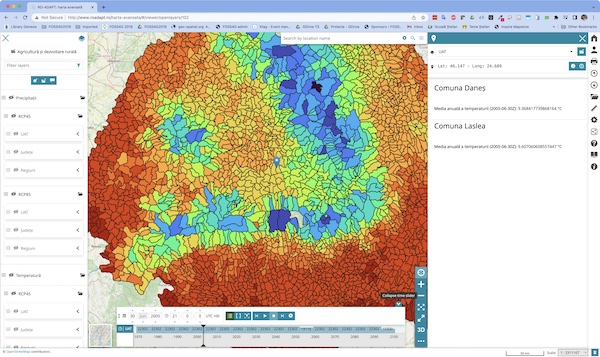
The advanced mapping application RO-ADAPT

Screen capture of the advanced mapping application RO-ADAPT
The advanced mapping application includes complex data management functionalities for RO-ADAPT
The list of functionalities of the application includes:
Cartographic representation of raster and vector elements (point, line, or polygon);
Querying attributes of displayed entities;
Displaying attribute tables for vector datasets;
Measuring distances and areas on the map;
Filtering datasets based on associated attributes;
Saving the context of a map and loading it in another session (Web Map Context);
Managing multi-dimensional data (e.g., time series, multiple levels of height/depth);
The layer list allows interactive selection of layers to compose the main map representation;
Grouping layers into groups and subgroups;
Reordering layers within a group through drag-and-drop;
Creating interactive charts;
Viewing information in a 3D environment using the standard WebGL technology;
Loading data directly from compatible services provided by other institutions in Romania and Europe.
Access the advanced RO-ADAPT map


